Introduction
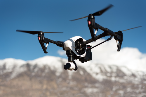
When most people hear the word drone, they picture a small quadcopter hovering in the air, capturing cinematic wedding videos, or being flown at a local park as a weekend hobby. For years, aerial photography and recreational flying dominated public perception. However, a quiet shift has been taking place across the commercial sector. Today, businesses are no longer looking at drones merely as flying toys or cameras with propellers. Instead, they are investing in complete, integrated systems designed to solve complex operational challenges. This evolution marks the rise of the modern drone platform. A drone platform is much more than the aircraft itself. It brings together the physical aircraft, specialized payloads, advanced flight-control systems, skilled pilots, data-processing software, maintenance protocols, and ongoing operational support. By combining these elements, organizations can collect accurate data, inspect hard-to-reach assets, and streamline fieldwork in ways that traditional methods cannot match. This article explores how commercial drone platforms are reshaping industries, what components make up these systems, and how modern businesses leverage aerial technology for practical, real-world value.
What Is a Drone Platform?
To understand modern aerial technology, it helps to look beyond the hardware. A basic drone is simply an aircraft controlled remotely or flown via pre-programmed waypoints. While useful for casual photography, a basic drone lacks the integration required for rigorous commercial tasks.
A professional drone platform is a comprehensive ecosystem designed for a specific business purpose. It combines several key layers:
- The Aircraft: The physical flying machine, which can be a multirotor for vertical takeoff and precise hovering, or a fixed-wing aircraft for covering large areas efficiently.
- Payloads and Sensors: The instruments carried by the aircraft, ranging from standard cameras to thermal imagers and LiDAR scanners.
- Flight Software: The digital tools used to plan missions, set automated flight paths, monitor battery levels, and manage airspace safety.
- Data Processing Workflows: The software and cloud infrastructure that transform raw imagery and sensor data into actionable maps, 3D models, and inspection reports.
- Human Expertise: The certified pilots, data analysts, and safety officers who oversee every mission.
- Support and Maintenance: The logistical framework ensuring equipment is calibrated, batteries are maintained, and firmware is updated.
Not every drone platform includes every component. A real estate photographer’s setup is vastly different from an infrastructure inspection platform used by a utility company. However, the unifying principle remains the same: the aircraft is just the vehicle delivering the solution.
Why Industries Are Moving Beyond Basic Drone Use
Organizations across sectors are adopting commercial drone platforms because traditional methods of data collection and asset inspection often involve high costs, physical risks, and time-consuming processes. Consider the task of inspecting a high-voltage power transmission tower or the roof of a large industrial warehouse. Traditionally, this required scaffolding, cherry pickers, or technicians working at dangerous heights. By deploying an industrial drone platform equipped with high-resolution zoom cameras, companies can capture detailed visual documentation from a safe distance in a fraction of the time. Similarly, in fields like agriculture and surveying, businesses need frequent, up-to-date measurements. Ground crews walking across hundreds of acres can miss subtle ground changes or crop distress. Aerial platforms provide rapid, repeated data collection, turning large expanses of land into detailed visual records. Crucially, the value rarely comes from watching the drone fly. The true return on investment lies in the output—whether that is a precise topographic map, an automated thermal scan identifying faulty solar panels, or a 3D progress model of a construction site.
The Main Parts of a Commercial Drone Platform
Building an effective commercial operation requires understanding the individual elements that work together during a mission.
The Aircraft and Propulsion
The airframe must match the operating environment. Multirotor systems offer unmatched maneuverability and vertical landing capabilities, making them ideal for tight spaces and close-up inspections. Fixed-wing drones, which resemble small airplanes, cover vast distances efficiently, making them suited for large mapping projects.
Power Systems and Batteries
Modern platforms rely heavily on advanced lithium polymer or solid-state batteries. Flight times depend directly on payload weight, weather conditions, and battery capacity, making power management a critical part of mission planning.
Navigation and Communication
Reliable positioning relies on multi-constellation satellite navigation systems, including GPS, GLONASS, Galileo, and BeiDou, often paired with Real-Time Kinematic (RTK) technology for centimeter-level accuracy. Secure data links ensure the pilot maintains telemetry connection and live video feed throughout the flight.
Ground Control Stations
Operators manage missions through tablets, specialized controllers, or ground control station software that displays real-time flight paths, battery status, sensor feeds, and airspace warnings.
How Sensors Make Drone Platforms More Useful
The versatility of a commercial drone platform largely depends on its payload. Different professional tasks require entirely different sensory tools.
RGB and Zoom Cameras
Standard red-green-blue cameras capture high-resolution visual imagery. When combined with optical zoom lenses, they allow inspectors to spot hairline cracks on bridges or wear-and-tear on wind turbine blades without flying dangerously close to the structure.
Thermal Infrared Sensors
Thermal cameras detect heat signatures rather than visible light. They are invaluable for identifying electrical faults, heat loss in buildings, overheating mechanical components, or locating people during search and rescue operations.
Multispectral Sensors
Primarily used in agriculture and environmental monitoring, multispectral sensors capture light wavelengths beyond human vision, including near-infrared. This data helps agronomists calculate vegetation indices and assess plant health across large fields.
LiDAR Systems
Light Detection and Ranging payloads bounce laser pulses off the ground and surrounding objects to create precise 3D point clouds. LiDAR is especially powerful in dense forests or complex terrain where standard cameras struggle to map the actual ground surface beneath vegetation.
The Role of Drone Software
Without software, a drone flight is simply a collection of digital image files. Software acts as the bridge between raw data and business intelligence. Mission planning software allows operators to draw boundaries on a digital map, set camera trigger intervals, define flight altitudes, and ensure automated obstacle avoidance. Once the mission is complete, photogrammetry and processing software stitch thousands of overlapping aerial photographs together. This processing transforms disparate images into orthomosaic maps, digital elevation models, and textured 3D models. Cloud-based analytics platforms then allow engineering teams, project managers, and clients to collaborate, take measurements, leave notes on specific inspection points, and generate automated compliance reports.
The Role of Skilled Drone Pilots
While automated flight routes and advanced software make missions look effortless, professional drone operations still rely heavily on skilled human oversight.
A trained drone operator does much more than flip a switch. Before takeoff, pilots conduct thorough pre-flight equipment checks, analyze local weather patterns, verify airspace regulations, and establish safety perimeters. During the flight, they monitor telemetry data, watch for unexpected obstacles, and maintain visual line of sight.
Automation can execute precise flight paths, but it cannot react intuitively to sudden wind gusts, unexpected aircraft traffic, or GPS signal loss. Human pilots provide the critical judgment required to pause, adjust, or abort missions safely when conditions change.
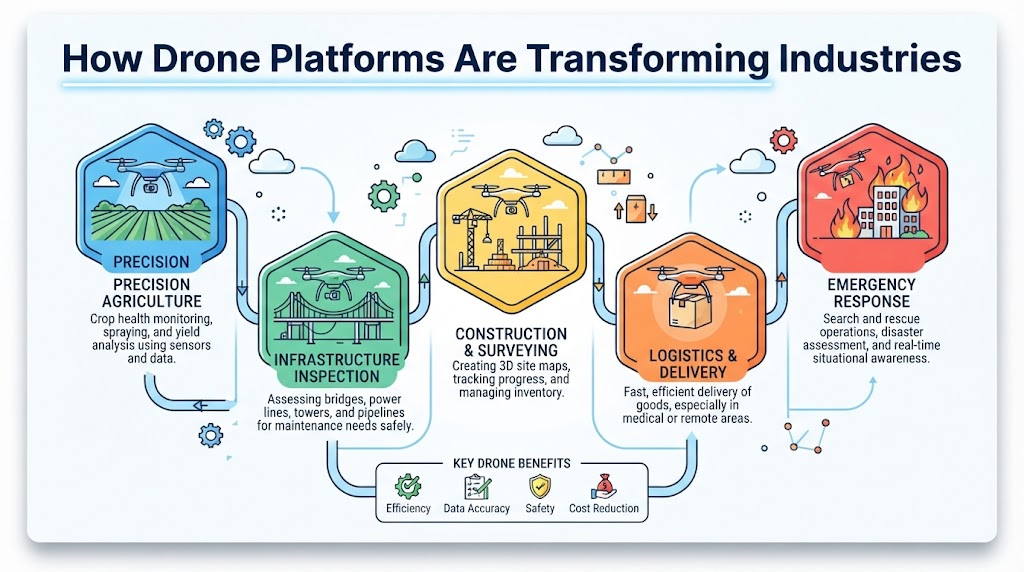
How Drone Platforms Are Transforming Agriculture
Modern farming relies on precision to maximize yields while minimizing resource waste. Drone platforms have become standard tools for progressive agricultural operations.
Farmers use drones for rapid crop scouting, allowing them to identify pest outbreaks, nutrient deficiencies, or irrigation failures across large fields before visible damage spreads. Multispectral imaging provides an objective view of crop vigor, helping agronomists apply fertilizers and treatments only where needed rather than treating entire fields uniformly.
In addition to crop health monitoring, drones assist with field mapping, boundary surveying, and post-harvest documentation. By capturing high-resolution aerial overviews, farm managers can plan drainage channels, monitor soil erosion, and track seasonal growth patterns with remarkable accuracy.
How Drone Platforms Are Changing Construction
Construction sites are dynamic environments where tracking progress and maintaining accurate measurements are vital for keeping projects on schedule and within budget.
Project managers use drone platforms to capture site maps, orthomosaics, and 3D point clouds at regular intervals. Comparing these periodic flights against original architectural blueprints reveals discrepancies early.
Drones also streamline earthwork measurements. By calculating the volume of cut-and-fill dirt piles from aerial data, construction teams can verify subcontractor quantities and monitor material inventories without halting heavy machinery for manual ground surveys. Furthermore, aerial photography provides a permanent visual record of underground utility placement before backfilling occurs.
How Drone Platforms Improve Land Surveying and Mapping
Land surveying requires strict accuracy. While drones do not replace traditional ground survey equipment for every high-precision boundary dispute, they have transformed topographical mapping.
Using photogrammetry, a drone platform captures overlapping images tagged with precise geographic coordinates from onboard GNSS and ground control points. Processing software analyzes these images to generate detailed elevation models and contour maps.
This capability allows surveyors to map large, difficult-to-reach terrain in a fraction of the time required by traditional traversing methods. Civil engineers use these maps for early-stage route planning, watershed analysis, and site preparation.
How Drone Platforms Support Infrastructure Inspection
Aging infrastructure requires constant monitoring to ensure public safety. Inspecting bridges, highways, rail networks, dams, and telecommunication towers traditionally posed significant logistical and safety hurdles.
Equipped with high-zoom cameras and thermal sensors, drones can inspect bridge undersides, structural pylons, and concrete spalling without disrupting traffic or putting inspectors in harm’s way. Repeatable flight paths allow engineers to compare high-resolution images taken months apart, tracking rust propagation, structural shifting, or crack expansion over time.
For telecom towers and power lines, drones reduce the need for climbers to scale live towers. Instead, automated routines capture high-definition imagery of insulators, bolts, and cables, highlighting anomalies for maintenance teams to review.
How Drone Platforms Are Used in Mining
Mining and quarry operations involve moving massive volumes of material across expansive, rugged sites. Safety and precise measurement are paramount in these environments.
Mining operators deploy drone platforms to conduct volumetric stockpile measurements, track excavation progress, and monitor pit wall stability. Regular aerial surveys provide accurate inventory audits without requiring surveyors to climb unstable material heaps.
Drones also assist with environmental monitoring, tracking dust dispersion, revegetation progress, and water runoff management across sprawling concession areas. This data helps site managers maintain compliance with environmental regulations.
How Drone Platforms Support Oil and Gas Operations
The oil and gas sector manages vast, complex assets spread across remote locations, deserts, and offshore environments.
Drones assist with visual inspections of storage tanks, flare stacks, and processing units while facilities remain operational. Thermal sensors help detect internal insulation failures, tank fluid level anomalies, or flare efficiency issues.
Along pipeline corridors, aerial patrols monitor right-of-way encroachments, soil erosion, and unauthorized excavation activities. In emergency scenarios, drones provide rapid aerial situational awareness, allowing incident commanders to assess leaks or structural damage without risking response personnel.
How Drone Platforms Are Changing Energy and Solar Inspection
The global transition toward renewable energy has created millions of solar panels and wind turbines distributed across vast tracts of land. Maintaining these assets efficiently is a major logistical challenge.
Solar farms are prime candidates for drone-based thermal inspection. A thermal camera mounted on a drone can scan thousands of photovoltaic panels in minutes, instantly highlighting hot spots caused by micro-cracks, faulty bypass diodes, or shading issues that reduce power generation.
For wind turbines, high-resolution optical cameras inspect rotor blades for leading-edge erosion, lightning strikes, and structural stress fractures, eliminating the need for technicians to rappel down spinning turbine blades.
How Drone Platforms Support Public Safety and Emergency Response
When natural disasters, fires, or search-and-rescue operations occur, every minute counts. Public safety agencies increasingly rely on drone platforms to establish immediate situational awareness.
During floods or earthquakes, drones map blocked roads, collapsed structures, and rising water levels, helping first responders plan safe access routes. In wildfire scenarios, thermal drones penetrate dense smoke to locate hot spots and guide firefighting crews.
During search operations in rugged wilderness or rural terrain, thermal imaging payloads help locate missing persons at night or under heavy forest canopies, expanding search capabilities while keeping rescue personnel out of hazardous zones.
How Drone Platforms Are Used in Real Estate and Media
While commercial applications extend far beyond media, aerial photography and videography remain important commercial segments. Real estate developers, tourism boards, and media production companies use drones to showcase properties, large architectural developments, and scenic landscapes from unique perspectives.
Professional platforms in this sector offer robust camera stabilization, extended battery endurance, and reliable transmission systems, giving creative professionals precise control over framing and motion in various weather conditions.
How Drone Platforms Support Logistics and Delivery
The concept of drone delivery captures significant public imagination. In specialized environments, unmanned aerial systems transport urgent medical supplies, blood samples, laboratory specimens, and small retail packages between fixed locations.
However, widespread parcel delivery remains constrained by regulatory frameworks, payload weight limits, battery endurance, air traffic management, and urban safety considerations. Rather than replacing ground couriers entirely, drone logistics currently serves targeted, high-urgency routes where traditional transport is slow or impassable.
How Drone Platforms Create Better Business Data
The true core of any commercial drone program is data. Collecting high-resolution images is only the first step; the real value emerges from how that data is analyzed and applied.
When raw images are processed into orthomosaics, 3D meshes, digital surface models, and automated inspection logs, they integrate directly into enterprise Geographic Information Systems (GIS) and Building Information Modeling (BIM) software.
This empowers decision-makers to measure stockpile volumes accurately, track construction milestones against timelines, detect thermal anomalies before equipment fails, and maintain verifiable historical records of asset conditions.
Drone-as-a-Service and the Growth of Outsourced Drone Work
Not every company wants to purchase, insure, and maintain a dedicated drone fleet or train in-house pilots. This reality has driven the rapid growth of the Drone-as-a-Service (DaaS) business model.
Through DaaS, organizations hire specialized service providers or independent operators to execute specific missions on demand. Whether a construction firm needs monthly progress mapping or a utility company requires an annual thermal scan of a substation, outsourcing allows businesses to access advanced drone technology and expert data processing without capital expenditure overhead.
How Drone Platforms Connect Different Parts of the Drone Ecosystem
The commercial drone sector is a collaborative network. Hardware manufacturers build airframes and sensors, while software developers create flight-planning and data-processing tools. Meanwhile, certified pilots execute missions, training institutes educate new operators, and regulators establish safety frameworks.
For the industry to mature, these various stakeholders must remain connected. Platforms that bridge the gap between drone models, pilot directories, training resources, and community insights help streamline the adoption of commercial drone technology.
How DronesNow Fits Into the Connected Drone Ecosystem
Navigating the commercial drone landscape can be complex for businesses and operators alike. DronesNow functions as a connected ecosystem that brings together drone models, certified pilots, training institutes, resources, and community discussions.
By serving as a central hub where professionals can explore equipment options, connect with skilled operators, and access industry insights, DronesNow helps simplify the process of integrating aerial technology into everyday business workflows.
How Businesses Can Choose the Right Drone Platform
Organizations looking to adopt drone technology should always begin with the specific business problem they want to solve, rather than starting with the aircraft itself. Key considerations include:
- Define the Output: What data do you need? (e.g., a 3D topographic map, a thermal report, or a visual progress record).
- Environment and Range: Will you fly in confined industrial interiors, dense urban environments, or wide-open agricultural fields?
- Payload Requirements: What sensors are necessary to capture the required data?
- Regulatory and Pilot Needs: What certifications and operational permissions are required under local aviation laws?
- Data Workflow: How will the captured images be processed, stored, and integrated into existing company software?
Answering these questions prevents organizations from overspending on unnecessary hardware or purchasing equipment that fails to meet operational demands.
Challenges of Using Drone Platforms
While the benefits are substantial, commercial drone operations come with distinct challenges. Weather conditions such as high winds, rain, and extreme temperatures can ground fleets immediately. Battery degradation, radio frequency interference, and limited operational range also require careful mission planning.
Furthermore, managing large volumes of high-resolution imagery demands robust data storage and processing infrastructure. Privacy concerns, site restrictions, and the need for ongoing equipment maintenance mean that running a successful drone program requires discipline, proper training, and realistic expectations.
The Importance of Safety and Compliance
Professional drone operations require strict adherence to safety protocols and local aviation regulations. Operators must verify applicable airspace rules, obtain necessary flight permissions, respect private property rights, and maintain visual line of sight during operations.
In India, commercial drone operators must comply with regulations established by the Directorate General of Civil Aviation (DGCA) and utilize platforms like Digital Sky for flight permissions and pilot registration. Staying updated with current regulatory guidelines ensures that all flights remain legal, safe, and professional.
The Future of Industry Drone Platforms
The next phase of commercial drone technology will likely focus on deeper automation, improved battery efficiency, and smarter onboard processing. Artificial intelligence will increasingly assist pilots by identifying anomalies in real time during flight.
As BVLOS (Beyond Visual Line of Sight) regulations evolve and uncrewed traffic management (UTM) systems mature, automated industrial inspections and corridor monitoring will become more widespread, further embedding drone platforms into enterprise operations.
Why the Drone Platform Matters More Than the Drone Alone
Ultimately, the flying machine is only one component of a successful aerial operation. The true value of drone technology stems from the seamless combination of the right aircraft, specialized payloads, skilled operators, robust software, and clear business goals.
By treating drones as comprehensive data-gathering platforms rather than standalone gadgets, industries can unlock new levels of efficiency, safety, and operational insight.
Frequently Asked Questions
What is a commercial drone platform?
A commercial drone platform is an integrated system consisting of an aircraft, specialized sensors, flight software, data-processing tools, and trained operators designed to perform professional business tasks.
How do commercial drones differ from hobby drones?
Commercial drones feature enterprise-grade build quality, advanced sensors (like thermal or LiDAR), RTK positioning for high accuracy, and specialized flight-planning software tailored for industrial applications.
Which industries use drone platforms most frequently?
Agriculture, construction, land surveying, infrastructure inspection, mining, oil and gas, energy, and public safety are among the primary sectors utilizing commercial drone technology.
Why are sensors and payloads important on a drone?
Sensors determine what kind of data the drone can collect. Different jobs require different payloads, such as high-zoom cameras for inspections, thermal sensors for heat detection, or multispectral cameras for crop health.
How does raw drone imagery become useful business data?
Specialized photogrammetry and mapping software process raw aerial images, stitching them together to create orthomosaic maps, 3D models, elevation profiles, and detailed inspection reports.
What is Drone-as-a-Service (DaaS)?
DaaS is an outsourced model where businesses hire professional drone service providers or certified pilots to conduct specific aerial missions instead of purchasing and managing their own fleet.
Do I need a trained pilot if the drone can fly autonomously?
Yes. While automation handles routine flight paths, trained human oversight is essential for pre-flight safety checks, weather assessment, regulatory compliance, and managing unexpected in-flight situations.
Are there safety and regulatory rules for commercial drone use?
Yes. Commercial drone operations are strictly regulated by aviation authorities. Operators must follow airspace rules, obtain proper permissions, register equipment, and respect privacy guidelines.
How should a business choose the right drone platform?
Businesses should start by defining their exact data needs, required sensors, environmental conditions, budget, and software workflow rather than choosing an aircraft based solely on specifications.
What is the role of DronesNow in the drone ecosystem?
DronesNow connects users with drone models, certified pilots, training institutes, community discussions, and industry resources, making it easier to explore and navigate the commercial drone sector.
Final Thought
The true transformation driven by modern drones lies not in the air, but on the ground. As aerial technology continues to evolve, the organizations succeeding with drones are those that view them as complete, end-to-end data systems rather than standalone gadgets. By integrating reliable hardware, specialized sensors, powerful software, and skilled human expertise into daily workflows, industries can unlock smarter, safer, and more efficient ways of working.
